
Gunung Rajah, Bentong, Pahang
Height 1685 m / 5526 ft
December 5-7 2010
Usually during the months of Nov - Dec we would take leave from going camping up in the mountains because of the monsoon season. That means lots of rain. When it rains the trail is slippery, muddy and filled with leaches. Not to mention the rising river when during river crossings sometimes are dangerous or difficult to cross. Setting up tents in the rain pose another challenge. And by saying that I would usually trek less and less means lower stamina.
When David of G7 Hash invited us for this trip, I was feeling reluctant but when it was mentioned a 3 days 2 nights trip, the feeling of reluctance change to anticipation. How fast things can changed in split seconds. What this means is that 3 days 2 night trip would signal a relax holiday trek to Gunung Rajah which for an out of shape guy like me wouldn't mind at all.
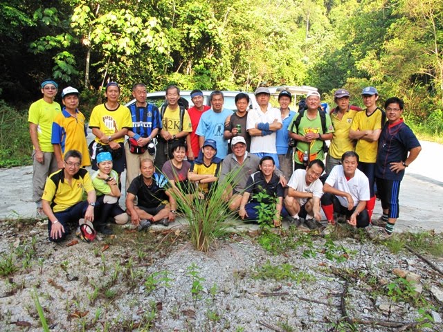
Hok Mew, KC and myself met up with them at Seri Kembangan food court just across the road from South City Plaza for planning the trip. Everyone was in a jovial mood and especially for KC as for the first time she doesn't need to cook. The campsite is quite spacious and just nice for 22 of us.
The plan was simple as day 1 trek 4 hours to campsite, day 2 trek 3 hours to summit and back, day 3 trek back to car park and home.
Gunung Rajah became infamous for a lightning incident that happened many years ago where 2 campers lost their lives. But Still... like they say... trekking and camping in the mountains is safer than traveling on Malaysian roads. Aren't you glad to hear that!
Gunung Rajah trail is through The Chamang Waterfalls which is about 8km from Bentong Town.
At Bentong Town in the morning the happening place is at their morning market where it is crowded with traders selling various foods and products. We meet at 8.00 am in the morning and had our breakfast there. Dim Sum here is quite popular and the other is the Wan Ton noodle at the corner shop. From nasi lemak to local delicacies you can find it here. The chinese here are predominantly of the "Kong Sai" dialects which is Cantonese but with a different pronunciation. After the walk about in the market and buying some local sweet delicacies like the "Sa Kae Mah" which is a sweet biscuit and tasty and the famous "tau foo pok" or the famous Bentong ginger.
We continue towards Chamang Waterfall carpark. Standing in front of Chamang Waterfalls gives you the feeling of energy and a great force as tons of water comes gushing down. Double check your backpacks and make sure what you need is there and gather for group photos. Take lots of photos otherwise you will forget some of the details. The start trail is about an hour following the old logging trail which will pass by a mini hydro electric dam and a small 'orang asli' community. All along the trail you would be able to hear or see the river and waterfalls. KC and myself were the last to trek. We have another group of friends Ah Meng, Ah Onn and friends who is on a 1 day trek to Gunung Rajah Summit and back to carpark had started the trek at around 7am. They were so nice to lay pieces of paper trail (biodegradable off course!) all the way to the peak. After passing the mini hydro electric dam 5 mins later we heard the sound of a 4wd behind us and suddenly stop to offered us a ride to the end of the logging trail. Without hesitation we jump in as this will save us a 1 hour trek and along the way they started picking almost half the group, Lucky us.
We continue on following the paper trail and finally stop at a river crossing for lunch break. About 10 mins later the rest of the group arrived. The river is clear and inviting us to jump in for a swim. Ate our lunch snack biscuits and the rest of the group trickle in.
Our next stop is to our campsite only to discover its half an hour away. This campsite is probably big enough for about 30 campers and with good clear swimming areas and a 3 storey high water fall below. Weather was fine with everyone finding their spot to pitch tents. It was too early for dinner so we took our bath and ate some biscuits snack, took more photographs till dinner time. Later Siow Lee and friends prepared dinner for 22 people and they make it so easy. Dinner was delicious and there was no left over.
The weather was just nice cool but not cold but the sand flies made their presence felt by giving almost everyone a bite. Tonight we rest early as tomorrow we will trek to the peak.
Day 2. Morning call and a quick breakfast of 'teh tarik' biscuits and bread. Pack a light pack of snack food and tea leaves. We started at about 8.45am and the weather was perfect. We just followed the paper trail placed by Ah Meng yesterday so it was kind of leisurely pace with plenty of time for taking photos. The trail is quite opened and clean with occasional large fallen trunks to cross over. We reached the usual bonsai peak and can actually view Gunung Rajah and here there are good opportunity to take photos especially with bonsai trees with its exposed red barks makin g the picture interesting. Another half hour we have to climb the steep almost vertical slope on the rock face using fasten ropes, roots and uneven rock for a slow ascend.We reach the peak at around 11.45am after trekking for about 3 hours and in a relaxing mood for photos and snacks and more photos. Stanley Chan with another group pointed to the various locations for Genting Highlands, Gunung Benum and other peaks. Later more photos and a slow trek back to camp to enjoy the waterfall and cool weather for another night. As for tonight KC brought her home made fruit cakes to celebrate my 50th birthday or half a century. Thanks to her for a wonderful birthday memory. Tonight everyone will sleeping late to enjoy the jungle and waterfall environment.
3rd Day, Breakfast simple with snacks and drinks. Pack up and leisurely trek out to the carpark and since its a holiday, Chamang Waterfall Recreation Park is full of visitors. You can take a nice bath by paying 30 cents or jump in the river for free. With so many other visitors I just pay 30 cents and for some they like the waterfall. Later we Lunch just outside of Bentong town before going home with good memories of another successful climb.
Click Play below for photo viewing
Dec 26, 2010
Gunung Rajah, Bentong, Pahang
Aug 27, 2010
Gunung Tapis
 Gunung Tapis & Pelangi Waterfall
1502 m / 4957 ft
August 5-9 2010
At our last climb to Gunung Benum Uncle Lim suggested Gunung Tapis and See Tho answered "I 'Tapid' first" (meaning I surrender). See Tho suffers from high attitude sickness during the Gunung Benum climb and promised himself that this will be his last mountain to climb.
Gunung Tapis peak is about 1502 meters or 4,957 feet above sea level. It is the 18th highest mountain in Peninsular Malaysia. The start trail is situated on the 4wd trail to the Pelangi Waterfall or Rainbow Waterfall (photo courtesy from Taman Negara Web) from Sungai Lembing. Sungai Lembing is situated 42Km North West of Kuantan, Pahang The Journey from Kuantan to Sungai Lembing is about 1 hour.
The normal trek to Gunung Tapis is about 2 days 1 night and due to the long drive from Klang/Kajang we decided to arrived 1 day earlier and stayed at Wong's home stay (019-9878631 A-3294 Lrg Kubang Buaya 4, Kuantan) which offers affordable and comfortable stay of about RM$20 - RM$25 per head room sharing.
Arriving a day earlier is  more relaxing and an opportunity to dine at Restaurant T & L nearby. And also to distribute the packages which include our stove, gas, food and flysheets. Morning call at 5.30am and Uncle Lim will meet us at the home stay by 6.00am and proceed to Sungai Lembing food court for our breakfast. Sungai Lembing is famous for their soft 'tau fu' so don't miss it when you come here. I park my car in front of the police station and hop onto Ah Onn's 4WD Hilux. Usually they charge about RM$35 per head for a 4WD to Pelangi Waterfall or a minimum charge of about RM$ 350 - RM$400 which can seat approximately about 12 persons. You can enquire when you arrive at Sungai Lembing Town.
Day 1Pelangi Waterfall or Rainbow Waterfall has become very popular with visitors where the best time to view is 10.00 am when the sunlight hits the correct angle to setup a beautiful rainbow scenery. The waterfall itself looks like a misty curtain of water droplets free fall from a height of about 2 to 3 hundred feet. The 4WD will stop before the river. Crossing the river on foot and about 30 minutes to the Pelangi Waterfall. Unfortunately the weather was cloudy and we did not get to see the rainbow. Later we stop at our start trail to Gunung Tapis at another river crossing. Sometimes during dry season and with proper tires you can drive your 4WD until Camp 1 which can save you about 90 minutes of walking.
We started trekking at about 10.45 am. following a old logging trail which followed the river until Camp 1 where we turn right towards Camp 2. You can find the Ikan Kelah or the Masheer fish (a gourmet delicacy) here and many locals will come here to fish. From Camp 1 to Camp 2 t he trail is open flat terrain covering about 7km and just our luck the sun is shinning brightly and it gets real hot. After Camp 1 you will start to notice lots of elephant dung (fresh one) and freshly flattened trees and and bamboos which indicate that a herd of elephants are nearby and judging from the foot print they are of rather large size. Its midday and the hot afternoon sun is wearing us out. Finally after 3 hours from the start trail we reached Camp 2 around 1.45pm covering about 11km to stop for a snack lunch. There is a stream nearby and we sat in it to cool down and a school of fish (small) of the red kelah variety swam nearby. Our original plan was to camp at the Gunung Tapis Peak which requires another 5 hours covering 6.5km and ascending 4000 feet. After trekking for about 30 mins towards Camp 3 we decided that it was too ambitious to reach Gunung Tapis peak on day 1. We felt if we had avoided the morning trek to Pelangi Waterfall we would have save about 2 hours.
 Its uphill trek to Camp 3 and its a hot afternoon and we reach our campsite by 4.30 pm. This campsite could fit about 30 campers fortunately only 7 of us here. The water stream nearby provides and excellent supply for our needs. There is a memorial plaque fix onto a small boulder found here. And uncle Lim would always place a small lighted candle at the memorial plaque. Upon enquiring the memorial plaque is dedicated to Mr. Joseph Cheong You Sang who promoted the Gunung Tapis trek had pass away on his last and final climb in 2004 at the age of 65. May he rest in peace.
KC prepared tea and biscuits for snacks while the others found their good spot to set up camp. Quickly took a bath before it gets too cold and KC prepared dinner to be served later. Dinner was a simple rice, eggs and vegetables. Later for supper hot ginger sweet potatoes were served. Tuck in our tents by 10.00pm.
Day 2.
Woke up early, had tea and noodles for breakfast. Did some packing and started trekking to Gunung Tapis Peak at 7.30am. Today's climb is ascending 2000 feet covering 3.5km that will require approximately 2 hours to Gunung Tapis Peak. Trekking at a steady pace we reach the peak at around 9.30am. It was a clear sky and Gunung Tahan can be seen towards North-West direction and Gunung Benum is noticeable towards West direction. We rested and enjoyed the mountainous view with tea and snacks. We started descending around 10.15am and reach Camp 3 around 12.30 noon. We pack up and continue towards Camp 2 about 2 hours later. By this time our body heat started heating up and when Ah Onn and Wong saw the river they quickly jump in like water buffaloes and soak in to cool themselves. From Camp 2 to our car park is another 11km of hot sun which will take about 3 hours trek. Its just walking and walking. Each time we cross a river we will find opportun ity to soak in it. Along the trail we notice some fresh elephant foot prints. Ah Onn told us if we see our friends (at the front) running towards us we should quickly put our backpacks to the side and run for your lives. This is because they are being chased by elephants. This sounded serious and stressful but on the positive note KC told Ah Onn that hopefully it won't happen. By the time we reach Camp 1 our legs felt sore, tired and very hot. Finally the last river crossing to our car park at around 5.10pm. Took a bath and head out to Sungai Lembing town for dinner and boy! we really felt hungry. We have been trekking since morning. Gunung Tapis height may look short compare to other G7 mountains in Malaysia but it does have its own challenging long trail.


Click on play below to view a slide show of photographs
Jul 13, 2010
Gunung Benum
Gunung Benum 2107m Pahang
10th Highest Peak in Peninsular Malaysia
9th July - 11th July 2010
A year ago we were invited to join a day trip to Lata Berumbun Waterfall (Sungai Chalit, Raub Pahang) and the highlight was the 45 minutes 4x4 adventure ride from Sungai Chalit town. Sungai Chalit along with Sungai Klau, Sungai Ruan and Tulai are famous for their agricultural produce and especially the Durian variety of the 'Mou Sang Wong' or Raja Kunyit. Durian plantations here are produced on a large scale and wholesalers can be seen along the road receiving durians especially in the mornings where they have to be transported out. Gunung Benum should not be confused with Belum Forest which is situated in Perak.
The 45 mins 4x4 adventure ride on the Jeep modified to turbo charged engine provides a thrilling ride and especially if the driver is motivated by screams from the passengers. The driver spoke of the Gunung Benum (10th highest mountain in Peninsular Malaysia) which is tough to climb. There are very few local Gunung Benum guides and they charge about RM$150 per person excluding 4x4 trasportation (RM$250 - $300 per vehicle). Our guide Mr. Lim from Kuantan who has taken us to Gunung Tebu (Terengganu) and Cemerong Waterfalls has agreed to take us up to Gunung Benum on July 9th - 11th without any charge.
This trip our group consists of Ah Onn (Klang), See Tho, Michael (driving from Kota Bharu), Wong, KC and myself. We left Kajang at around 5.00 pm 8th July to stop at Bukit Tinggi for tea and snacks. Later arriving in Bentong to buy the famous 'tau hu pok' as one of the ingredient for a 'bak kut teh' dinner which KC plans to cook for dinner during the first night at Camp Tikus (our campsite). We meet at the Restaurant Lo Yong for dinner. Later Lim from Kuantan and another 3 campers join us for the famous 'mou sang wong' durian which was priced at RM$16 per kilo (The price is like share market, sometimes up sometimes down). Later we camp at the Kuan Yin Temple in Kampung Cina Sungai Chalit for the night.
Day 1.
Pack up and breakfast in Sungai Chalit Town before heading back to Kuan Yin Temple where we will park our cars and take the 4wd at around 9.00am to Lata Berumbun Waterfall. Dark clouds can be seen circling around the mountains. It had rained the night before so the 4wd trail gets muddy near the Lata Berumbun Waterfall. We were pack 5 to a vehicle together with our backpacks. It was a bone rattling ride like riding a wild horse. Upon reaching the muddy trail the first 4wd stalled and had to be winched. With the turbo charged engine throttling at high speed with the wheel spinning we were soon splash with mud. 10.00am Finally at Lata Berumbun Waterfall park we disembark and started warming up for the trek to Camp Tikus which will take an averaged 4 - 5 hours. Lim and his friends are strong trekkers and have treked Gunung Benum to camp in one day. They have also trek (small day pack) Gunung Benum and back to Lata Berumbun Waterfall in one day. These people are like commandos.
The start trail (2,000 ft above sea level) goes into the jungle and soon we become aware that this is 'leech' country. At the small river crossing, Lim and his friends started to mark the trail with pieces of paper because tonight at around 9.00pm another 8 campers will start night trekking to Camp Tikus. The others started to check for leeches. Along the trail there are many thorny plants which needs be to cut or chop. There are not too  many trekkers to Gunung Benum so the trail tends to get overgrown with plants, thorns and fallen trees. The first day climb is a gradual steep 3,000 feet climb and for the first 2 hours leeches big and small are waiting for you. So walk a little slower to let them have their meal.
I was told that the trail towards Gunung Benum you can find 3 distinctive 'items'. 1st is the large pitcher plants usually after the Camp Tikus. 2nd Large millipedes and 3rd Large rats usually near Camp Tikus (Rats Camp). I didn't seen any large millipedes and rats, maybe its their off season but lots of leeches to be found. Luckily I wore knee length ladies stockings and full length tights. Leeches cant penetrate the ladies stockings so sometimes there are some adventurous leeches that will climb all the way up and find a juicy spot around the belly to suck blood.
We reach Camp Tikus around 2.30pm and quickly found our spot to put up our tents. Up in the mountains sometimes the weather changes quickly so it is better to set the tents. Water source is downhill about 2 mins just beside the trail towards Gunung Benum. The water is tea brown in colour probably due to tree trunks and dead leaves but nonetheless very clear. Have tried drinking it and taste like light chinese tea. Its better to be boiled for those with weak stomachs. You can take a bath further down from the collected pool of water (still tea brown in colour) and its icy cool at 5280 ft high. From the campsite you can see Genting Highlands and probably Gunung Rajah on a clear day or night.
KC as usual will be preparing ceylon tea and instant noodle. After a long trek the meals and drinks up here always taste different. As for dinner tonight KC has planned 'bak kut teh' vegetables, mushrooms and fried chicken feet (fried and supply by Onn) with 'bak kut teh' herbal ingredients from Klang famous 'mo sang ko'. Later a sweet desert of longan and 'lo hon go' to cool down.
We just had tea and noodles at 5.00pm and then dinner by 6.30pm! Talking about losing weight with mountain climbing is not possible here. A hash member once told me that he join hashing to lose weight and had four blocks of muscle around his abdomen. After running for about 6 months his four blocks of muscle now becomes only 1 big block and that is his beer belly.
After dinner it rained and we collected water using our flysheet which can be use for drinking and washing. See Tho did not sleep well and he felt chilly throughout the night. Around 1.45am the group of 8 arrived trekking throughout the night. I am thinking to myself another group of commandos. These people are tough.
Day 2
Woke up at 6.00am. Today's climb is suppose to be tough and comparable to Gunung Chamah as there are about 35 hills to climb which consist of small hill and big hills. Small hills from 100 ft to about 750 ft covering about 12 km. We had tea and 'mee suah' for breakfast and carried some extra water to make hot 'milo' drink at the peak along with bread and snack bars. There are no water source from here onwards so you have to ration about 1.5l of drinking water. We started our trek at around 7.30am. We started at altitude of about 5,280 ft and for the next 2 hours we will be going up to 5,800 ft and back to 5,250 ft. Strange huh! but that is the nature of the toughness of Gunung Benum trek.
After an hour we started to notice large pitcher plants about 15 inches in height. They grow all over the place from ground level to tree top level. We started to take photos with the standard pose to ridiculous pose (which I will avoid posting, you know 'lah'). There are about 2 viewpoint of far away mountains which I cant identify.
For the next hour its just trekking and walking and walking until you reach a 'left behind' campsite maybe from past expedition and that will be an other 1 hour plus to the peak. There are about 2 false peaks of about 750ft in height and the 3rd peak shall be the Gunung Benum Peak. Arrive at the peak at about 11.45am. See Tho looks pale and he then realized that he has high attitude sickness. That explains for his headaches and high heart beat rate. Took photos and hot milo, bread and biscuits for lunch before descending at 12.30 pm to campsite. It took about 3.5 hours to reach campsite at about 4.00pm.
Since it was early KC started chatting with Lim from Kuantan and possibly which mountain for the next climb and it was suggested Gunung Tapis and Pelangi Waterfall at Sungai Lembing, Kuantan, Pahang. Pelangi Waterfall is also known as rainbow waterfall. A little while later sand flies started appearing and what they do best is bite and suck blood. Either you wear socks or apply some anti-insect cream. KC prepared leek fried with sardine and french beans with anchovies which was quickly eaten with nothing to spare. Retired to tent at around 10.00pm and it started raining heavily after midnight. Our flysheet collapsed due to overload of water and my tent in particular was drenched. Had to re-tighten the 2nd layer flysheet for my tent so that water stops seeping in. Went back to sleep in wet and cold condition.
Day 3
Woke up early and started packing while KC prepared a simple breakfast of hot milo with biscuits and snack bars. All pack and ready to go at 7.45 am. It was most downhill and the trail was slippery due early morning rain. Slip a few times and hook by thorns. Leeches were plenty and they were better prepared and got their fill of blood. Reach the river crossing at around 10.15am. Going downhill is definitely easier and faster. Some of us went to the Lata Berumbun Waterfall to wash up in the icy cold water. There were a group of campers who was packing up and getting ready to leave at the waterfall. Our 4wd was schedule to pick us up at around 12.00 noon. We heard the trail was quite inaccessible due to the heavy rains which had made the trail muddy and later Ah Ngah (HP 019-946 0807) our 4wd driver came and told us to walk out towards the next river crossing where they will ferried us back to our parking at Kuan Yin Temple about 45 mins away.
By the time all of were packed and ready to leave Kuan Yin Temple after taking a good bath it was around 1.30pm. The whole group dispersed to different restaurants for lunch. Our group of 6 went back to Restaurant Lo Yong to have our lunch. Later we contacted a local farmer for durians of the 'mou sang wong' variety along with mangosteens and bananas.
Overall it was a good weekend reaching home sweet home.
Statistics.
1. 45 mins 4wd to head trail near Lata Berumbun Waterfalls.
2. 4-5 hours to reach Camp Tikus (full backpack), distance about 8km with elevation of 3,200ft
3. 4-5 hours to reach Gunung Benum Peak (small day pack), distance about 12 km
with elevation of 1,700ft covering 35 hills.
4. 3-4 hours from Gunung Benum Peak to Camp Tikus.
5. 2-3 hours from Camp Tikus to Lata Berumbun Waterfalls.
6. Total distance to and fro Gunung Benum is about 40km
Click on play below to view slide show of trip to Gunung Benum

Gunung Benum Trail
Click to enlarge view
Thanks to malfreemaps.com
Mar 25, 2010
Gunung Bintang - Kedah/Perak Border
 Topography map thanks to Malfreemaps
Click on Map to view enlarge
Gunung Bintang (Mount Star) (1862 m/6,144 ft March 19-21 2010 )is located on the border of Kedah/Perak near Kulim. The gathering point is at Sung
 ai Sedim Waterfall or Sungai Sedim Forest Recreation Park. This is the highest mountain east of Penang Island. To reach Sungai Sedim Forest Recreation Park from Kuala Lumpur via the North-South Expressway exiting the toll at Bukit Merah to Selama. Alternatively it would be better to exit the toll at Alor Pongsu to Selama.
Sungai Sedim Forest Recreation Park has many attractions including the The Tree Top Walk or Canopy walk which is over 900 metres long and highest point at 50 metres. White water rafting is available here and it offers two packages. The most challenging being 6 hours ride from Level 1 to Level 4. Level 1 being easy to Level 5 which is considered too difficult or impossible. Other activities include mountain biking and team building events. In fact TV3 Explore Race final was held here in 2006.
Day 1
Our journey started from KL and stopping in Sungkai at 1.30pm to meet up with another 5 friends to have lunch. The distance from KL to Sedim park is around 450 km and its better to take breaks during the long drive. After lunch we stop in Ipoh to have Ipoh famous white coffee and tea and finally dinner in Selama. While getting ready to eat in Selama the local council decided to fog the town and thus we had to stall our dinner awhile later. Guided by our GPS we pass through Mahang town and then towards Karangan town. Turn right before Karangan town and arriving at Sedim Park around 8.30pm. There was scattered showers and the ground was wet. Another group had camped at the trail head to Gunung Bintang. Sedim Park guide offered us accommodation in the wooden chalets back at the Park for RM$30 per chalet (max 6, comfortable for 4). We quickly took the offer as tomorrow will be a tough day ahead and after the many hours of driving this offer we couldn't resists. With bathing facilities it felt like 5 sta
 r and after refreshing ourselves, KC brought out the red bean desert for everyone to enjoy. We place an order for 20 'nasi lemak' at 60cents a pack for tomorrows breakfast. We chattered awhile before we repack our backpacks for tomorrow's trek and slept around 11.30pm.
Day 2
Sleeping in the chalet was comfortable but it gets chilly and cold after midnight. 7.00 am rise and shine to have Sungai Pelek 'charcoal' bake bun for breakfast with 'teh O'. The 'nasi lemak' we ordered didn't arrive on time until much later at the start of the in trail. After packing we parked our cars near our chalets and were ferried by Toyota 4wd to join with the rest of the group (total 24 pax). The 4wd trail takes about 15 mins or 1 hour by foot to reach the headtrail. 3 4wd were use to ferry all of us and finally to begin our trek at 10.00am. Our next stop was a Campsite 1 which is currently under construction to build a hall with other smaller
 gazebos beside the waterfall. The head trail begins with a fairly flat gradient through what looks like a old logging trail with occasional bamboo grove overhanging the trail. And along the trail you will notice wild ginger flowers (reddish in color) and elephant droppings. The height here is around 1200 ft above sea level. Leeches are 'seen' along the trail and what's not 'seen' may have already started biting you. Along the way I rested a few time leaving my backpack on the ground and later found 1 leach already had its fill near my belly and the other at the back. They probably came up via the backpack. At around 11.40 am we reach Campsite 1 which a slow trek would require about 2.5 hours. We stop for a short snack and rested at the waterfall while others took pictures.
The trail to Campsite 2 is a gradual steep climb of about 3000 ft with occasional short downhill. One good thing is that the trails are well kept (by guides) and clean. From here onwards it gets tougher and with little sleep from last night we had to take more short stops to rejuvenate our strength. Along the way 'Siow Lee' from Serdang, Selangor was busy pointing out the many various wild orchids. Finally we reach Campsite 2 at around 3.15pm, the clouds looks menacingly dark even though we read in newspapers that Northern Malaysia was dry. My knees aches, it was injured three weeks ago and looks like it haven't recovered. Michael reach the campsite much earlier and 'book' a good spot to set up tent and cooking area. As usual we put up our tents and emptied our backpack contents into the tent and wrap up the backpack in big black garbage bag. This was shown to us years ago by a regular camper from Malacca (Chee Eng Pow). Keeping your backpack in garbage you can either tied it to a tree for safety and dry instead of keeping it in your tent which will definitely "smell". And of course more space in your tent means more comfort. Water source is about 50 m downhill (steep) and the guides told us that the water is crystal clear and icy cold even fishes cannot survive here. Not believing we went down to take a bath and collect water. Mark his words the water here is really icy cold. On second thought a sponge bath sounds more warm. I had the 'pleasure' to carry 10 liters of water uphill and its tiring. KC was already preparing hot water to make tea and a quick 'instant noodle' to satisfy our hunger which everyone quickly finish. And after that 'power nap
 ' but KC was excited because she is preparing "all in one" dinner called Herbal Fish Vegetable Soup serve with hot piping rice. Sounds Delicious? What took about an hour of preparation was consumed in less than 15 mins. 7.00pm still bright but from a distance dark clouds
  gathered with the sound of rumbling thunder. Chit chat time... till about 9.00pm and it started to rain so..... crawl into tent to sleep. "listen to the rhythm of the falling rain.... pitter patter pitter patter..wouuuh woh..." nice song.
Day 3
Wake up 7.00am KC went out to prepare our simple breakfast Fish Porridge (getting very fishy) while the rest started packing their stuff. The weather is fine and fresh from last nights rain. Today's trek to the peak will take about a "slow" 2 hours or a "fast" 1 hour. Just bring enough drinking water and snacks in a small backpack. We left campsite 2 at around 8.15 am. The ascend up is gradually steep again with a few downhills and our first stop was at the Bonsai Garden (8.35 am). The trees here takes up many slanting shapes and sizes as with most mountains due to strong winds and cold weather. There was tree with its bark almost completely strip off on one side possibly due to bears or even big cats. I call this the "scratching pole" for these big four legged friends. Next stop is at Gunung Bintang Kecil (9.20 am Mount Small Star) again taking many photographs and it is noticed from the last stop that there are many species of wild orchids with some of them blooming. Gunung Bintang is another half and hour away. All the way the trek is clean and wide, no climbing involved and this mountain is popular with trekkers from Penang Island. Finally we reach Gunung Bintang around 9.55 am. On a clear cloudless day you can catch a glimpse of Penang famous Komtar Tower and Penang Island but it was not to be as today it is cloudy and misty. Spending time here to relax to take more photos. There are small communication poles with solar charged batteries located around the peak. Most of them damaged by elephants. According to the guides, usually a small herd of elephants would normally arrive from Grik from June
 onwards for food. And on seeing this man made structure like the communication pole or the signboards they will destroy them. Amazing! And when they go back to Grik they will usually leave behind a young bull elephant to guard the area (outpost guard). Interesting! Now for some hot milo prepare by KC (the ever willing cook) to go with cakes and biscuits. After enjoying the mountainous view its time to descend. My injured knee starts complaining but still have to walk. Returning back to the camp takes a shorter time and more opportunity to take photos. Once we reach Campsite 2, a final pack up took about 20 min and reach Campsite 1 around 1.30 pm. Stop here for a quick lunch and to soothe our sore legs in the cool water of the waterfall. The weather turns for the worse with menacing dark clouds circling above. Left Campsite 1 around 1.40
 pm and it started pouring. All along the trail it became slippery downhill from the rain water flow off. This time leeches were having a '24 person' high tea with enough for a second round. Finally reaching our head trail around 3.15 pm. By this time our muscles really ached because of walking in the rain with the muscle cooling down fast. At the 4wd gathering point everyone was inspecting for leeches and was especially found on most juicy part of the body. By the time everyone was ferried to the Sedim Recreation Park it was around 4.30 pm.
Since it is a Sunday the park was filled with visitors. Bath time at the river but be careful since it rained heavily and you will never know when the river would suddenly rise. Left the Sedim Recreation Park around 5.00pm for Nibong Tebal to have sea food especially the "Tu Boo Sung" in hokkien means small octopus and mini sweet & sour sting rays. Since it's the last day of the school holidays we took an extra hour to reach home with the heavy traffic.

