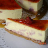
On Sunday 1oth June 2007 we had help to organised a Shaklee Ipoh family day at Rumah Rehat Adeline also known as Adeline Rest House. Rumah rehat Adeline is situated 6KM away from the Gopeng main road. We have been there three years ago when Adeline has not started the rumah rehat resort. We were there to see the rafflesia flower and Raja Brooke butterfly colony. The 4WD ride was 1 1/2 hours and another 1/2 hour walk before we reached the spot where the largest flower species (rafflesia) bloomed. Now three years later her rumah rehat not only provides waterfall and jungle trekking trip, it also provides caving in Gua Kandu, White water rafting, wet abseiling and team building events. Not forgetting her best home cooked local food packages with accommodation. This eco-resort has been featured in many local newspaper for its food and authentic orang asli type of accommodation but you have to enjoy nature minus the luxury of your home like spring mattress, water heater, air condition room, TV & Radio. I would give two thumbs up for this fantastic environement with great food.
Our family day was a one day event package with one tea and one lunch. There were 14 children and 25 adults. We started our team event at 11am. Today we are all boys and girl, not husband and wife, it is a wonderful opportunity to play as children. We have the boys and girls to line up and split them into five teams with 6 members each team. Our team building consist of team members sharing a bit about themselves, brick walk relay, balloon blowing relay and fancy dress with given items. Guess what? One family with 6 members was divided equally in every team, we overheard one young participant said it is a good idea because no matter which team win, one of the family member will definitely be in the winning team. The team building ended at 1pm. We had fried noodles, curry puffs, local "kuih" (cakes) with 'tea tarik' for a light snack. We proceeded to the waterfall, this is just one of the many waterfalls in this area, and in another stream shaped like a natural slide where you can do body rafting. It look fun and dangerous but once you try the short one and gain your confidence, you can try the longer one which is exhilarating, they had fun in the water. We had our late lunch at 4pm and we were served rice with 9 different delicious dishes and also "luk-luk" (skewed food dip in soup and dip with spicy sauce). It was a very satisfying lunch. It started raining and the weather was cool. In this eco resort we practice washing our plates and cups after food. We have prize giving for the winner on team building and some personal sharing from the participants. One participant even shared that it has been a long time that her family had been together with such experiences. together. She has two grown up sons and both in the college. We left Rumah Rehat Adeline at 6pm. We will be organizing another trip there in the month of July 21st and 22nd and expecting to have lots of durian because it is a durian season already.
For your next trip, you can plan to this eco resort by calling KC at +6019-3339825
Jun 20, 2007
Rumah Rehat Adeline, Gopeng, Perak

Jun 12, 2007
Gunung Datuk, Negeri Sembilan,
20th May 2007
We have taken a group of friends to Gunung Angsi early this month and when the group asked which is the next gunung? Guest what? The answer  is Gunung Datuk. Gunung Datuk (2900') is situated in Negeri Sembilan and it is only 110' higher than Gunung Angsi (2790'). Whenever anyone mentioned Gunung Datuk, they always said the peak has the best 360 degree unobstructed panorama view. Highly recommended for beginner and also an orientation and exposure for beginner before climbing higher mountains.
On Sunday we met up at Senawang Toll in Seremban. It was only a one day trip and our group consist of 10 members, 6 from Kajang and 4 from Klang. Always prepare a name list before hand. Passing Rembau town and drove another 26km and you will find the Hutan Lipur Gunung Datuk signboard on the left. Turn left and drive all the way in until you see another sighboard on the left. You will not miss it if you follow the sign closely. When we reached there, while the other members unload their gear, KC went to submit the name list and paid RM3 per person for the climbing permit. KC even weigh everybodys backpack and the weight average 5KG per person. The chief cook ask all the member to carry 1.5L water (excluding self drinking) for cooking and tea 'tarik'. We started trekking at 10am and after 30 minutes of trekking we stopped for a rest and waited for the last member to catch up and he was 'pucak' (pale) when he arrived. He had 'maggie mee goreng tambah pedas' and milo ice for breakfast. Advisible not to take any spicy food stuff before any climb because it will cause indigestion for some people. The trail is a straight forward uphill and steep, the path is wide and visible all the way. Always walk in a group of 2 to 3 and along the way we left some small paper as trail marker especially when there is junction.
We reached the peak at around 11.40am and there were already one camper packing and leaving. So we have the campsite all to ourselves even though it was a weekend. While KC was preparing tea 'tarik' some of us went up to the peak to enjo y the 360 degree panorama view. Today lunch was 'mee fan kuid' (knead flour dough for making noodle). After our yummy! yummy! lunch we started packing and cleaning with tissue paper. Make sure you bring all your rubbish back even empty container. At the peak there is a fiber tank filled with rubbish.
We spent 2 hours at the peak and started decending at around 2pm. Along the way we took some nice photo of wild flower and big, big tree. The trek down was only 1 hour a nd instead of having our bath in the resort all of us went for a dip in the cold, cold mini waterfall. After the refreshing soak, we decided to have our early dinner at Seremban town at 5pm but to our suprise the restaurant was already packed with people. The restaurant was famous for its claypot 'sang yee' (fish) and the restaurant was also featured in ASTRO .
Have fun and be happy!
This posting by KC
Gunung Angsi, Kuala Pilah, N. Sembilan
On 29th April, a group of friends from Klang,Kajang and Micha el from Malacca decided to hike up to Gunung Angsi (2,700 ft.) using a shorter route. Our gathering venue was to be after the Senawang Toll Plaza at about 9.30am. After meeting we head towards Kuala Pilah after passing through Senawang and up the hilly and winding road, just when you approach a big sign "Selamat Datang ke Kuala Pilah" there is parking area on the right. Usually on weekends and holidays many trekkers would walk up to the peak which usually take two hours along this shorter route and there is another route which starts from the Hulu Bendul Recreation Park where the journey would take about three to four hours to reach the peak. As usual being the organiser of the group each was given some food portion for carrying. Each of them have to carry their own drinking water with extra 2.5l of water for making hot drinks (tea tarik and milo). We started our journey at 10.15am. The entry point is just beside the main road and steep climb all the way for about 45 mins. The trail is well marked you won't miss it because almost every weekend many locals will climb up and down. We reach a plateau and there we met a regular climber who call
  himself "kor low" or tall fella. He has cleared a well kept rest area either to rest and camp for the night. Instead of going up a steep hill there is a old logger trail on the right, follow the logger trail to the end and go straight into trail where both side are covered with high shrubs. If you decided to have a challenging climb, take the steep hill climb and it will meet at the main trail after another 20 mins. Again another climb up for about half hour where you will meet a junction. Both way will also lead you to the peak. An average climber will take less than 2 hours. At the peak we met other groups who were surprise to find that there was a shorter trail.
As usual other group will just munch their snack and bread and relac for half an hour and decent. Normally we will make hot tea tarik and some snack, later hot soupy noodle and lastly hot tea again for the last round. After the eating session we will relax and enjoy the view. This peak is very popular especially during holidays and sometimes they will bring extra water to camp overnight. During the eve of National day or New Year you could catch the fireworks display from afar or just enjoy the night during a full moon night.
After almost 1 hour of rest and relax we will pack and have a group photo. The decent will take and average of 1 to 1 1/2 hours. Upon reaching the car park, there is a small mini reservoir where natural stream water flows in and it is half covered with a green shack, this is where you can wash down or even take a bath the water here. Once everyone had changed to a fresh set of cloths and the first thing on our mind "food",  I suggested going for the famous "Hakka Yong Tau Foo" at Mambau town and everyone was gamed for it. The time was about 4.00pm and once we entered the highway through Senawang Toll we got caught in a jam due to road works and finally exited through the Port Dickson Toll about an hour later which normally would take about half an hour. This eatery was once featured in The Star newspaper and it looks like and ordinary shed once you put your teeth in a feeling of satisfaction comes in after burning your calories. Fearful of the traffic jam a further suggestion was that we continue towards Sungai Pelek (small town near to KLIA airport) and stop at this EP Hoon Seafood Restaurant and this time a full 8 course seafood delight. What ever calories we burn now we have triple putting it back on. We part ways, friends from Klang took the coastal road via Tanjung Sepat (fishing village), Banting. And as for Kajang via Sepang-Bangi road.
This posting by KC
Kuantan River Cruise, Pahang, Malaysia

Last Saturday 5th May 2007, the three of us was on a Shaklee business trip to Kuantan - the gateway to east coast of Malaysia. We left Kajang at 10am and stop at Wangsa Maju to have our breakfast with some friends. After breakfast around 11.30am we proceeded to the East Coast Highway through KL Karak highway. We arrived at Kuantan at 2.30pm and delivered one carton of products to our Kuantan friend in Jalan Teluk Sisik. We have our early tea in one of the many Kopitiam in Kuantan and our local friend suggested going for river cruise which many locals have never been. One boat which can carry maximum 20 person and minimum 5 person. There are only 4 of us. We waited for a while and nobody turn up so we ended up paying for 5 person fares (RM15 per adult) The cruise sta rt at 4pm in the late afternoon. Cruising time is around 1 hour 15 minutes. The cruise will take us to the open sea of South China Sea. We enjoy the picturesque view of Kuantan town, beaches and along the Kuantan River the traditional fishing village settlement and one of the few largest reserve mangrove swamp in Malaysia. A bridge was built across to Tg. Lumpur. We have the boat to ourselves and the local guide and our local friend take turn to entertained us with songs. We stop for a 15 minutes mangrove boardwalk. After the boardwalk we proceed back to the jetty.
Time to look for accommodation. Stop at a few hotel to check for best offer. A double bed room normally will cost from RM90 to RM135. We managed to get the best offer for a double bed plus extra mattress for only RM93 and furthermore it is a new hotel. (Hotel Grand City) Our dinner appointment is at 8pm so we have plenty of rest and shower. Tonight dinner is at a halal seafood restaurant. We ate asam fish, tow foo, a vegetable dish and scallop dish located just in front of Citiview Hotel ask any local and you will find the place. After dinner we were invited to our friends karaoke club at a double storey shop lot for relaxation and entertainment.
Morning breakfast at a shop famous for Seremban curry noodle and we also get to enjoy the famous Sg. Lembing bean Curd. We attended a business session in a hotel in the afternoon and in the evening we went for the famous "Char Kuay Teow" at Jalan Beserah and later to Teluk Cempedak beach to enjoy the evening sea breeze. Again meeting time at the same hotel from 8.30pm to 10.30pm. After the meeting we say BYE BYE and left Kuatan and reach Kajang at 2.30am in the morning. Have fun and enjoy!
This posting by KC
Jun 3, 2007
Gunung Yong Belar, Trans Titiwangsa Perak, G7 Mountain Malaysia
17th Sept to 21st Sept 2006 (5 days 4 nights)
We have already scaled the six highest mountain and this is the last G7. Gunung Yong Belar (7156') is situated in the three states of Perak/Pahang/Kelantan. This trip our plan was to scale the three mountain at one go and the route is considered to be very tough. Some of the me
 mbers (included Michael) have not climb Gunung Korbu and Gunung Gayung in our earlier trip. This trip there are two groups, one group will only climb Yong Belar and the rest will proceed to climb the three. The logistics for this trip were complicated because the in trail and exit were different. Our entry point is through Kampong Rajah (
 veryone tried to get the best site to set up their tent because the ground was soft and soggy from the rain and wet conditions. The height here is around 6000 feet and the weather gets dark and it felt chilly. We had to set up the tent in the rain, team cooperation is vital here. The water source is downhill about 10 minutes and looking very brownish, if you really like cold water (really cold), take a full bath here. Everyone was tired, we took a quick wipe down to clean up (not full bath), KC prepared hot drinks and noodles to satisfy our hunger. Mind you this is only a snack meal but because of the exhausting climb we soon fell asleep and forgot our dinner. All night long it was raining, its wet in and out of the tent, cold but we needed rest.
Day 2 Morning call at 7am luckily it stop raining and it was windy. After our morning br
 eakfast everyone went for toilet "business" (bowel movement), we started packing and left by 9am. Only 1 hour to reach the peak. The returning group went first thing in the morning and we met them on the way up. For some of us celebrated our completion of G7 by letting of firecrackers. Usual group photos and some hoo ha and we proceeded to the next
 Day 3. H2O to Gayung peak is a 7 hours climb and very very steep. We passed a peak call
 ailable place is taken up, here you have a panaromic view. We reach the peak around 4pm and lots and lots of photos taken because the secenery here is the best. You can see G. Korbu, G. Yong Belar and G. Yong Yap. and nice sunset.
Day 4. Morning call for sunrise photo. After breakfast and packing we have our group photo again. Started trekking at 9am and reach Korbu peak at 11am. Rest and relax and have our lunch. Photo session again. Trek down 2 hours to the last water point if you come up from Camp Seroja. All the way very steep lots of dangerous slopes but well mark and with points for your hands and foot. We reach Camp Seroja at 5pm. Set up tent and had a very very nice bath because we did not have a bath since H2O campsite. We tried to finish most of our food, normally we have 3 dishes but today we have up to 5 dishes to celebrate our achivement. Later at night we have tea 'tarik' and talk about all the previous trips.

Day 5 After breakfast we trek out to Sg. Leming orang asli settlement but the orang asli settlement was evacuated for dam building. The last trip we paid RM20 each for the orang asli to transport using their motorbike to the Kinta Damp intake . This time no more orang asli but we are even more lucky to get to ride on a lorry 'hantu' and each of us paid the driver RM5 otherwise we have to walk under open hot sun for 2 hours. The lorry ride is about 30 to 45 minutes. Back to civilization and the first thing take out money and treat ourself with cold 100Plus drink. Later some of us went to the river and washed up and waited for arrangement to ferry us out to Ah Meng house where we parked our cars.
May 3, 2007
Gunung Yong Yap Perak, G7 Mountain Malaysia
7th July - 9th July 2006
Gunung Yong Yap (7113') is situated in the state of Perak and it is the 6th highest mountain in West Malaysia. Our team (YK, KC, Wong HM and Michael Lim) checked into a resort in Cameron Highland on the 6th of July. The climb will start from Kampong Brooks 2KM after Kampong Raja in Cameron Highland. We had our dinner in Brinchang town, sitting outside in the cool weather and eating hot piping food and chinese tea just feels wonderful. We also get to eat some durians (king of fruits). And staying a night in Cameron Highland is cool and refreshing. I did some research before this climb especially that Gunung Yong Yap is home to the endangered tiger with all the hype we were actually concerned but our goal is to complete the G7 and that is something very important in every climb. That you need positive thinking besides all the training.
Day 1. We had breakfast in one of the many eateries and met up with the rest of t he group and proceeded to Kampong Brooks to regroup. Ah Meng and his orang asli porter waited for us beside the road near to a school. The orang asli guided us to park our cars and those with 4WD will be required to carry the rest of the members to the next orang asli settlement for the in-trail. Our team member bought 1 pack of 10kg rice as a gesture for the orang asli. The 4WD ride was more like a 4WD adventure because we had to cross a few rivers and through old logging trail. We were in Ah Meng's Suzuki 4WD and he has to make another trip out to fetch the rest. We started trekking around 10.30am and along the way we passed through some durian orchards and Ah Meng collected some wild durian (jungle variety), it tasted Ummmh! very pungent and gassy, my advice is try to avoid it as along the way when 1 or 2 members started to burp and the smell is unbelievable. As we were crossing some narrow trail KC shouted that she was stung by bees and everyone
  ran. Three casualties, KC had about 10 bee stings, Wong 3 and another member by the nickname "sour pineapple" who had only 3 bee stings but was the most affected.
We stop to administer first aid, KC and Wong just got off with painful stings but for "sour pineapple" his body started to develop rashes, he jump into a small stream and started scrubbing his body with sand (bad idea). I later gave him some medication 1 for itch and the other (very mild steroid) for infections. He managed to continue and arrived at base camp at around 2.30pm, he felt very uncomfortable probably due to allergic reaction, just drink plenty of water and rest. As the campsite was overgrown with bushes, the orang asli started to clear a larger campsite. There is a small stream just enough to dip for 2-3 person and our source of drinking water. It was still early and we have tea 'tarik' and steamed 'pow' (dumpling). Some of them even brought along newspaper to read. We had fried Hokkien Mee cooked with fish cake for dinner. Imagined famous Hokkien Mee with chilly shrimp paste in the mountains. Mmmm.......Rest early as tomorrows trek is about 4 to 6 hours.
Day 2. After breakfast we packed some light food and proceeded to the peak. All of us except for "sour pineapple" who still felt uncomfortable had to miss the peak, we started trekking at 7.40am and reach the peak at 11.40am (4hours). We have buns from Sg. Pelek and our famous Milo shake at the peak. After group photos we decent all the way down to the campsite which took us less than 3 hours. Tea 'O' and instant noodle first before our bath and started preparing dinner. Tonight dinner is yam rice cooked with fried shrimp and chilly. Supper was tea 'tarik' with 'Tiger' biscuit and groundnuts.
Day 3. After breakfast we left our campsite at 9am and reached the orang asli settlement at 11am. Everyone bathed in the nearby river. We bought bamboo walking stick and blowpipe from the orang asli. The 4WD took us out to Kampong Brooks where we parked our cars. This trail is much easier compare to the entry point through Kuala Mu which is much tougher. Good luck and have fun!
Apr 3, 2007
Gunung Chamah , Kelantan G7 Mountain Malaysia
We have scaled 4 G7 in 2005 (Gunung Tahan, Gunung Korbu/Gunung Gayung and Gunung Ulu Sepat). This year we planned to scale the others 3G (Gunung Chamah, Gunung Yong Yap and Gunung Yong Belar). We started with Gunung Chamah (7123') and it is the 5th highest mountain in the Peninsular Malaysia and always been noted the most challenging one. This G5 lies in the most western corner of Kelantan. On the 9th March we traveled by Karak via Kuala Lipis to Gua Musang and checked in a hotel in Gua Musang. We did some last minute shopping in the pasar malam (night market) and later had dinner with the other group members. Later back to the hotel to do final packing. Our guide Ah Meng will only arrive early next morning through the Simpang Pulai/Gua Musang highway. He has already booked two 4WD to ferried us to the intake.
Day 1. After breakfast at Gua Musang and met up with Ah Meng and later he went to submit a name list to the police station. It is a recommended procedure before any climb in Malaysia. We later followed the 4WD to Kampong Bethis which is 26KM away and parked our cars there. Here the orang asli charged a parking fee RM5 for each car. One of the member drove his 4WD following the two chartered 4WD to Pos Simpoh. It was a bone rattling ride for almost 3 hours in the exposed sun. Some of the member even complained it was tiring and energy drenching even though there is no walking. Being a lady, there is always extra advantage because I always get to sit in the front passenger seat. Stop over at Pos Simpoh orang asli settlement to have some rest and lunch while waiting for the other 4WD because they have to keep a distance to avoid orange (dirt track) dust. Drove for another hour till the logging trail become impassable even to the 4WD. We hiked up the hill in the hot sun (really hot) for two hours along the exposed eroded timber logging trail. One hiker even came prepared with an umbrella. One of our team member even have leg cramps for the first time and we later found out that he has been wearing a new knee guard for the first time. The trail descended and we were relieved to be hiking in the shady jungle at last. At last we can hear water gushing as we were approaching our campsite
Day 2. After breakfast, prepare 'Lui Char' (a special vegetarian meal) for lunch at the peak and make 'Min Fun' dough for dinner. We started our journey around  Tongkat Ali is a 3 hours trekking, the last water point is 3 hours to the peak. After the stream, the trail become very steep before we arrived at our first false peak. Normally when there are stunted Bonsai tree we thought it was the summit. A short descent into a valley lead us to another grueling climb up an 80 degree slope to the second false peak. 3 more false peak (just like stock market, up and down) and at last the G. Chamah peak. Small open area with small miniature oak trees for shade. Started preparing our lunch, boil water and mixed the 'lui Char' paste and the rest of ingredients such as peanut, long bean with bubble rice. Our 'lui char' paste was prepared by our Hakka friend. There is a light drizzle and strong cold winds. Our last member arrived and have his lunch and tea tarik followed by group photos. Our guide told us that we must make our decent not later than
  ember is too exhausted until he did not eat his dinner, he just took some buns and straight into his tent to sleep. For the four of us we have big feast ahead because tonight dinner is 'mee fun kuih'. It was a ikan bilis soup and hand made kneaded flour dough. After dinner the orang asli served us roasted tapioca and millet without sugar. We boiled sweet potatoes with old ginger for our supper. Very satisfying dinner and supper.
Day 3. Morning call, after breakfast we trekked out to the place where the 4WD left us earlier. Again bone rattling ride for 3 hours to out car park. There is a big river behind the orang asli huts. All of us went down to the river and have a good bath and swim. Later bought ice cream from the orang asli. We have our lunch at Gua Musang, the food there was expensive and a plate of noodle will cost us about RM4. This trip most of the member suffered serious diarrhea and one of them even was admitted into the hospital. Be careful when you camp near an orang asli settlement because they do their call of nature every where and so do their pets and livestocks. Our digestive system may not be able to handle such water borne bacteria. When rain comes it may just wash to the stream. Make sure you boil your drinking water. The members that suffer diarrhea usually occur after about a week and it takes a while for your body to recover.
Gunung Chamah is considered to be one of the toughest to "climb" because the tough 3 hour 4WD drive, the expose trail under the hot sun, the many false peaks where you have to climb up and down for about 4 times with each ascend and descend of about 1000-1500 ft. Its certainly satisfying and looking for the next mountain that is Gunung Yong Yap.
This posting by KCClick on the above to view slide photos.
Mar 3, 2007
Gunung Ulu Sepat, Perak, G7 Mountains of Malaysia

30th Sept 2005 - 2nd Oct 2005
Gunung Ulu Sepat (7,091') Perak
G7 Mountains Above 7,000 feet
This G7 is situated in state of Perak. Out of seven highest mountain in the Titiwangsa Range you will find 5 of them in the Perak state. The other two which are not in Perak are Gunung Tahan and Gunung Chamah. After our Gunung Tahan and Gunung Korbu/Gunung Gayong trip, this is our 3rd. On the 29th Sept we went to Ipoh for lunch and later proceeded to Grik to check into a hotel and later met up with others members to have dinner. Grik Town is also famous for its local dishes especially fresh water fish and frogs (edible type).
Day 1. After breakfast at Grik town, we waited for other members who travel from KL (journey takes about 5-6 hours by North South Highway) . One of the member missed the trip because her backpack was stolen the night before. We drove to Pos Kemah lead by our guide Ah Meng. He is a very experience guide and has good contact with the head (penghulu) of the 'orang asli' (abrogines). Parked our car at the jetty and reported the name list to the police. We took an hour boat ride to the jetty Pos Slim. Another 1 hour bullock cart ride to the furthest orang asli settlement. Gunung Ulu Sepat is supposed to be the easiest among the G7 and the first campsite takes only 4 hours, when we arrived at the campsite, it was raining heavily. We brought along an umbrella for this trip and found it useful for setting up the tent in the rain. The rain stopped as soon as the tent was up and soon many of them were complaining of being bitten by sandfly or "agas" in Malay language, these sandfly are present when wild animals have passed by, they are very aggressive and work very hard.
Day 2. After bre akfast, pack light refreshment to the peak. Only 4 hours to the peak and 3 hours back to the campsite. We were suppose to stay for night but most of the members unanimously agreed to pack and trek out because they are afraid of the sandfly. We arrived at orang asli settlement at 8pm at night. The head of the orang asli offer the hut for us to stay. Some prefer to camp outside. For us who stay in the penghulu house and do our cooking in the house. We were served roasted and boiled tapioca which are their main diet. We left behind a lot of food stuff for them. We were told that the penghulu has many wives, children and grandchildren. The village altitude is around 3,000 ft. and it gets cold in the night.
Day 3. After breakfast we went out to tour the village. Took pictures of the carefree children and we noticed there were no teenages or adults and we found out that very early in the morning they have gone into the jungle presumably to hunt for food. At around 11.00am our bullock cart arrived to transport us to the jetty for boat ride again. Considered to be a successful climb but nightmare with the sandflies, many who had been bitten even after a month they sometimes still feel itchy, and for some they scratch till they bleed
.
The penghulu told us that when there are a lot of sandflies means that the wild animals are near by the vicinity . We are lucky enough because we have not seen any of them but only bitten by sandflies. Make sure when you plan any trip to Gunung Ulu Sepat be prepared for sandfly and brings lots of balm and insect repellant. Later we have lunch at a Chinese village along the way out of Grik town to celebrate our successful climb.
This posting by KC
Click Play to view photo slide
Feb 3, 2007
Gunung Korbu & Gunung Gayong, Perak, G7 Mountains of Malaysia

30th June - 2nd July 2005
G7 - Mountains above 7,000 feet in W.Malaysia

Day 1. Ah Meng lead us into the Ulu Kinta Dam intake. Parked our cars and get ready to trek and we are so lucky that an engineer (Mr. Warwick) with the dam project and also Ipoh HHH member offered to transport (4WD) us to the Camp Sg. Teming an orang asli settlement. Without 4WD transport it will take us 2 hours to trek there. Mr. Warwick has to make a few trips to transport all of us in. Started trekking at 11.00am and reach camp Seroja at 3.00pm and Camp Kijang is another 2 hours away. Camp Seroja is a bigger campsite and next to the river. There is a beautiful small waterfall enough to be your personal jacuzzi. We pitch our tent at Camp Seroja instead of Camp Kijang. Today is relaxing and comfortable.
Day 2. After breakfast we started trekking at 9am and by lunch time we reached the last water point, well marked. Stopped here for lunch and carried water rationing of about 3L per person, this is compulsory for camping at the peak (no water at the peak). Reached G. Bo
 tak (5960') at 2pm and have some photos taken. After this it is steep climb all the way before finally reaching the peak at 5pm. Set up tent and change to our dry cloths. Because it is still early and we managed to take some sunset photos. We can see Ipoh from the peak. It is very windy and cold at the peak. The two orang asli had left their tent at Camp Seroja but instead brought a fly sheet. We thought nothing of it until sleeping time at around 10pm, when smoke started entering our tents that we found out the orang asli were setting a bonfire because they were freezing cold. One of the members gave up his tent to them (lucky for them) and shared with another.
Day 3. Wake up early (by 6.00am) to take photos. After breakfast we were ready to trek to Gunung Gayong at 8.30am. The trail started with stunted trees and open view and later into a mossy forest as though you are in Gunung Irau (famously known for mossy forest i
 n Cameron Highland). We reach Gunung Gayong at 10.15am. Have some rest and group photo. We started to trek back to Korbu peak and have our lunch and packed up and decent at 12 noon. We reach Camp Seroja at 5pm, feeling tired, we quickly set up tent and have our instant noodle and hot tea 'O' to warm up our stomach before taking our bath. We had a nice bath as previous night we went without. Rested till around 7.00am and then prepare a mixed vegetable and salted fish for dinner. In the jungle and tired, this meal taste 'best in the world' and the grand finale with hot tea before relaxing and talking about the last two days journey.
Day 4. After breakfast and packing, we started trekking at 8.15am and reached Camp orang asli Sg. Teming around 11.15am. While waiting for the rest of the team we negotiated with the orang asli to fetch us by motorcycle out to the Ulu Kinta Intake. The charge was RM20 per head otherwise we have to walk for 2 hours under the sun. What do your think?. There are a few small shops in the Hutan Rekrasi Kinta where we had cold canned drink and later went down to the river to bath and change to a set of clean clothings kept in the car. We went to a restaurant in Ipoh for our lunch and also to celebrate our successful climb. Ah Meng joined us and during lunch we discuss and plan the next trip with him. The seventh highest mountain that is Gunung Ulu Sepat (7091') Perak in September.
This posting by KC
Jan 3, 2007
Gunung Tahan, Kuala Tahan, Pahang
How to Get There
From thePacking List for G. Tahan climb Recommended.
Personal
1 set climbing outfit (to be worn for next 7 to 9 days)
1 set camp outfit (to be worn after bathing in the river)
1 dry fast towel
1 sweater for cold weather
1 track bottom (optional)
1 sleeping bag
1 sleeping mat
1 pair slipper
1 torchlight (led type, energy efficient)
1 windbreaker
1 set personal hygiene, toiletry kit
1 set spoon,cup,plate or billy can or mess tin
1 toilet roll (2 person to a roll)
1 lighter, swiss army knife (or similar type)
* keep an extra dry set of clothes to be stored at the hotel/car
Group
1 set cooking stove
1 set cooking pot
1 pc floor sheet
1 pc fly sheet (for shade)
3-4 can camping gas 450g depending on cooking requirement
1 camping light or a set of candles
1 set first aid kit incl. anti-diarrhea, anti-histamine (bee sting), pain killers (fever, general pain)
any personal medical requirements (pls inform others)
1 set sewing/repair kit (shoes, hiking bag)
2 set of cameras with enough batteries to last for the journey.
Food should plan extra 2 days for emergency. Bring light or dry food, with proper nutrition and bulk.
Important: - All clothing/sleeping bags to be kept wrap in plastic to avoid getting wet either due to rain or river crossing.
Recommend backpack size for Male 55-75 liter, Female 45-55 liter. Hydration pack or 1.5 liter bottles for carrying water.

Climbing Team Members (5)
YK Low, KC Wong (my wife and team leader and chief cook), Michael Lim, Wong Hock Meow, Goh MY
Journey Log
1st March 2005, Day 1 Kuala Tahan to Kuala Melantai 12 km. 4 hours.
The members of the team assemble at my house in
We then walk our way down to the jetty to catch a boat to cross to the other side. Then the walk up the steep staircase left us breathless, we proceed to the rangers office to register our team. We had to submit a list of our items that we are bringing for the estimated 6 nights 7 days trek up the summit as this is a requirement that we do not leave any non biodegradable items behind. 12.00 pm the weather was hot and humid but nonetheless it was perfect, our guide gave us some safety instructions that includes walking in pairs and waiting at certain points along the trail. Our team was in high spirits as we started our trek. Our plan was to stop every 1 hour for about 10 minutes for a break. Along the trail we had to pass many river bridges which provided a scenic view under the bright sunlight. We were entering deeper into the jungle with many unmarked trails only to be safely guided by Man Panjang.

The first day climb is regarded as light and easy or a warm-up to many trekkers as it has quite a fairly flat terrain with occasional steep hills but short. 4.00 pm finally we reach our Melantai campsite with enough space for about forty campers, it is surrounded by many tall trees, bushes and there is a small stream nearby which is our source for drinking water. Wong Hock Meow the oldest at 52 years arrive half an hour later. We set our camp and quickly prepare our hot drinks either tea or milo (chocolate malt drink) follow by a packet of instant noodle, this is to satisfy our stomach. And bath or clean ourselves as early as possible because the water in the jungle is always cool or cold.
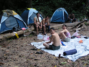
Later after dinner, Wong Hock Meow our oldest team member told us that he only did some jogging for the last 2 weeks before the trip and twice trained in Broga Hillshttp://www.kajangtown.blogspot.com (hilly village near Semenyih, Selangor). If we had known he wouldn't be joining this trip. He also has the biggest tummy, sitting on the log in picture below. Rest early by 9 pm, 1 hour later we were waken up by noises, using torchlight we discovered that there were jungle rats looking for food. We were prepared; our backpacks were stored in big plastic bags, food in plastics stored in tent, careful that you don’t lose your food ration.
Journey Log
2nd March 2005, Day 2 Kuala Melantai (camp) to Kuala Take (camp) 20 km. 12 hours.
Wake up call 6.00 am but delayed till 6.45 am by then Man Panjang would start shouting "Bangun! Bangun! Bangun!" (Bangun means wake up). He knows if we start late we would have trouble reaching
We stop at Camp Tengah for break and snack, as we lay our backpacks to the ground and remove our socks and shoes the whole place would be swarming with bees frantically landing on our gears, they are usually harmless as long as you don't touch them. Our water source is just about 20 m downhill where water flows sparingly but it is crystal clear and taste cool and fresh. Continue along the ridge and after an hour or so we reach Gunung Rajah (576m) an open patch of land, great for taking some aerial photos of the surrounding hills. Then there is long and steep descend which takes another 1-1.5 hours to Kuala Puteh. The sound of gushing water can be heard long before you reach Kuala Puteh. 2.00pm. a spectacular view of the river where you can drink, swim and rest. KC started preparing hot drinks an hour later Wong HM arrives looking tired and very appreciative when KC offered him tea and noodles. 3.30pm we were discussing with Man Panjang whether to camp or continue as it was getting late. Base on our pace we expected to arrive at Camp Teku around 8.00pm. Camp Teku was the base camp for the first successful

We proceeded, there are 7 wide river crossing and it is advisable to use a hiking pole or cut up tree branches use as a pole. Make sure your dry stuff is well tied in plastic bags just in case your bag decides to go for a swim. During the wet season the river will be too deep to cross and there is another trail which is longer and crosses many hills this should be the 2nd decision to take, the 1st is wait until the river subside and the last turn back. During the dry season it is not deep and usually reaches the waist but because the river bed is covered with rocks of various sizes you can easily slip. It takes about 4 hours to reach
We lay our backpacks and suddenly we felt so light. Like season campers I would lit the gas lantern as it was already dark, and set up the tent, KC would prepare hot drinks and noodles, and the others would do the same routine. Setting up the tent is always priority because if it rains it will be one messy affair. If it does rain, two person would hold the floor sheet (use as shelter) while the other two would set up the tent until all the tents are up and then tie up the floor sheet over the cooking area. Cooperation is vital here. While we sat down and started to remove our shoes, (how good that feels as our feet were never dry and especially with the river crossing) and put on slippers. We ate noodles and drank tea before we proceed to the river to have a good bath; the water is icy cold. The water level in
Journey Log
3rd March 2005, Day 3, Kuala Teku to Gunung Pangkin, 8 km, 7 hours.
6.30 am Bangun! Bangun! Bangun! Man Panjang called, it was wake up time, our body feels like a ton, still aching and not responding well. Day 3 this is going to be a tough day because it is steep all the way to Pangkin campsite, you will climb 1500m in one day. Our backpack weighs heavier with some of our stuffs being damp. It feels heavier even though it is around 18-20kg. KC as usual will be preparing breakfast and the rest will be busy packing up and getting ready.
Wong was optimistic and ready to continue despite the pain. What a relief, for a moment I thought we had to cancel this for the second time.
That brings back my memory that in Aug 2004 only after 2 days at
8.45am Man Panjang suggest if we would like to leave some can food behind by tying it high up in the trees as this will lighten our load. We took his suggestion but some experience climbers would prefer not to. Carry about 1.5 liter of water which should be sufficient until the next water source at Wray’s Camp also known as Rest Camp or Gunung Pondok Dua. As usual before your body warms up it is tiring to do 45 - 75 degrees climb but we just kept on, only stopping to catch our breaths. From this point onwards the vegetation starts to change with more ferns, stunted trees, mossy and in some areas the ground is soft. It feels cooler and quieter without the sound of water gushing and splashing during the first two days, sounds of birds and monkeys could be heard. After climbing for about 3 hours we stopped to eat our muesli bar and meal shakes (alternative snacks for example power bar, chocolate bar or mushroom soup with bread). 2.00pm Wray’s Camp, stop for half an hour break. We filled up our water containers, one of our large containers was leaking (for your climb it would be good if you use 1.5 liter water bottle as water containers). 4.00pm Gunung Pangkin (campsite) here the place is not large like Teku Camp but enough for about 15-20 person. If you are fit and can carry extra water, you can also camp at Gunung Tangga Lima Belas which is another one and a half hours climb away. This site has a fantastic view but a very cold place at night due to its exposed position. We decided on Pangkin Campsite. Michael the youngest will be celebrating his 38th birthday today.
Michael (with youthful energy and knowing that we will be celebrating his birthday that night) followed Man Panjang (he knows a few places) to collect water for tonight and tomorrows requirement. They came back about 45 minutes later all drenched with sweat with no extra water for bath but only a wet towel for cleaning up. Unbelievable with the cool clean air you don't feel sticky and smelly, probably we have gotten used to it. After the usual hot drinks and snacks everyone sort of just laze around or take a rest before dinner. The weather started to feel cool and with fading light. KC started preparing dinner, it was one of the very best dinners we had and immediately after that we stuck candles into the fruit cake to wish Michael a happy birthday, he make a wish, took a deep breath and blew out the candles. Later he told us that he wished for a successful climb to the peak and to become successful in life. Happy Birthday Michael! Time to sleep and because of space constraint we had to camp side by side and we could hear snoring, deep breathing, sounds of quietness and continuous sounds of insects making a chorus of jungle music.
6.30 am Bangun! Bangun! Bangun! Woi Bangun! Nanti gelap sampai peak! It feels like freezing, more to come at the peak, quickly we pack up and have our breakfast. Today’s climb is around 9 hours to the peak and our target is to reach before nightfall. You wouldn't like to continue trekking in the dark at such high altitude. Next stop is Gunung Tangga Lima Belas, how the name came about, I am guessing is that from the top of Gunung Tangga Lima Belas you have to descend almost a 20-30 foot high vertical drop with only ropes, roots and the rock surface to go down. All along the journey you could see different types of flowers especially from the wild orchid species; whenever we stop to rest we would take out our cameras and take what ever that interest us. By noon we had climb up to Gedong it is rocky terrain with low growing shrubs and plants. This place is considered to be our last water point to the peak and back. Our guide told us that there are many water sources from here to the peak but sometimes they run dry so as a last resort he would go looking for it, so until then each person should carry about 3 to 4 liters of water. Without shade it is hot and be careful as we can dehydrate easily. We began to ask wheres the peak, Man Panjang with his experience, prefers not to answer our questions and gave an excuse that it was taboo to ask this question. You could see a well mark trail going over many hills straight ahead and he told us after that you will be able to see Gunung Tahan.
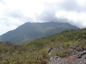 As we walk on the trail with shrubs and low lying plant with very hard and rigid branches you can’t help brushing those branches for hours. After 1 hour our thighs and knees began to feel sore. I remember that I had brought along a pair of knee guard and put it on, what a relief. Along the way the scenery is breathtaking with rolling hills and valleys and without civilization in sight. You will pass by a small plane that had crash there many years ago and what ever that is left of it as some trekkers of the past will eventually collect souvenirs from it. Man Panjang was not able to shed some light as to the origin of the plane. After another hour or so we came upon the view of Gunung Tahan, finally! But you still have to climb several hills before reaching the peak. At this time we are walking on the ridge slowly rising towards the peak, it is very windy and you could see the mist caressing by horizontally carried by the wind.
Gunung Tahan signing on the guest book

5.00pm Michael first to reach the peak, followed by
Journey Log
5th March 2005, Day 5, Gunung Tahan to Wray’s Camp, 16 km, 7hours
7.00 am Bangun! Bangun! Bangun! like a precise alarm clock, actually we tried to get up by 5.45am to watch the sunrise but it was our unlucky day as it was too misty or cloudy. It feels cool and as cold as last night, quickly we ate our breakfast, pack up leaving our wet clothes to put on at the last. Bbbrrrrrrrrrrrrr one last look around and off we go, down with a quicker pace to warm up the body. Somehow it feels nearer, maybe we have achieved our goal but it took us 7 hours at a slower pace as Wong's injured toe begins to feel sore and very swollen, on checking we found 2 of his toe nails was coming off. On every stop we took extra pictures, my advice is to take as many as possible because when you go home you will complain that you should have taken this and that... Upon reaching Wray’s Camp, it started to drizzle, luckily it stop after half an hour. That night we just lazed around the floor sheet and gazed at the stars, magnificent view, wow........
Journey Log
6th March 2005, Day 6, Wray’s Camp to Puteh Camp, 7.5hours.
Took a real good bath at the river. Scrub from head to toes mmmm it feels good. This time another two of Wong's toe nails begin to wobble. He had almost single handedly use up the tape from the medical kit.
7th March 2005, Day 7, Puteh Camp to Melantai Camp, 6 hours.
Wong is really slowing down, today we were supposed to walk to Kuala Tahan but because of his condition we had to slow down. Gave him some heavy pain killers and some mild steroid (prescribe by a doctor friend for this sort of emergency). Tonight KC cook most of our food ration, we had plan for a 7 day trek with 2 days extra food. Everyone felt very relax as tomorrow we will be going out.
8th March 2005, Day 8, Melantai Camp to Kuala Tahan, 4 hours.
Wong felt better, finally at noon we walk out and straight to the Forestry Office to report our exit. Before issuing us with certificates, they inspected our garbage which we brought out and check the balance of our stuff when we first reported in. And the final confirmations from Man Panjang only then they issue us the certificate. We gather at the van, took our time to pack and change into a fresh set of clothing. Had lunch all 6 of us eating at the floating restaurant down by the river. Going home with wonderful memories and a good experience of our trip.